In MHT's public directory

Mountains · Al Batinah
Al Akhdar Mountains
الجبل الأخضر
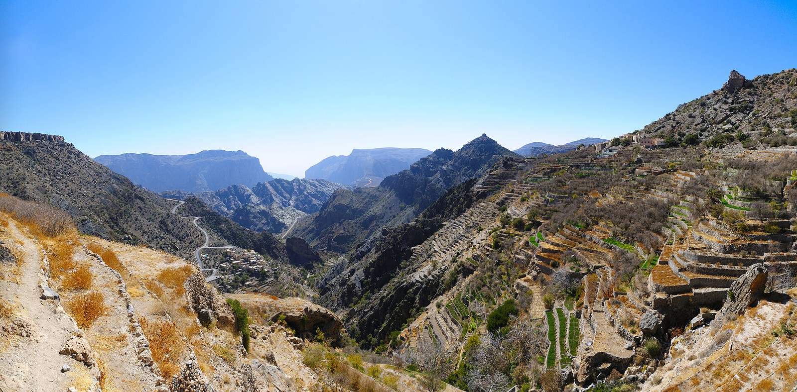
Photo: Jebel Akhdar view.jpg · Philipp Weigell · CC BY 3.0 (licence)
Before you go
7 facts, each with its source- Time needed Half a day Source: editor · category default
- Best season October–May Source: editor · category default
- Difficulty Hard — steep and exposed, and the drive is part of it Source: editor · category default
- Family friendly Older children — sheer drops are rarely fenced Source: editor · category default
- Drones Permission required from CAA Oman — approvals have been suspended at times in 2026, so confirm the current position before you travel Source: official · national rule · Civil Aviation Authority (CAA Oman) · checked 2026-09-05
- Dress Oman expects shoulders and knees covered in public. Layers: it runs 10–15 °C cooler up here. Proper walking shoes. Source: editor · category default
- Elevation 780 m Source: srtm · NASA SRTM 30 m model
Not confirmed for this place: 4x4 needed · Entry fee · Opening hours · Facilities · Wheelchair. Know one of these? Tell us →
Safety notes
- Mountain tracks can be steep with sheer drops. Check the fact box for 4x4 requirements; some routes are closed to two-wheel-drive vehicles.
- Temperatures at altitude are much lower than on the coast; carry layers and enough water for the hike.
Editor notes, reviewed 2026-09-02
How far is it?
- 2 h 8 mfrom Muscat Airport (MCT) · 153 km
- 2 h 21 mfrom Ibri · 134 km
- 2 h 27 mfrom Muscat (Mutrah) · 183 km
Road distance and driving time from OpenStreetMap routing, without traffic. Mountain tracks are often slower than the router thinks.
When to go
October–May- J
- F
- M
- A
- M
- J
- J
- A
- S
- O
- N
- D
ComfortableToo hot
High ground stays pleasant into late spring; winter nights are cold.
Source: editor · category default · 2026-09-02. Category default set by the editor — a verified per-place season replaces it.
mountain range in the central area of the Hajar Mountains, in Oman
Short description from Wikidata (CC0) · Q285951
About & Sources Al Akhdar Mountains
Al Akhdar Mountains is a mountain in Al Batinah, Oman — Wikidata describes it as "mountain range in the central area of the Hajar Mountains, in Oman". Entry fee, opening hours and vehicle requirements have not yet been verified for this page — the fact box says so plainly rather than guessing, so check locally before you go. For this kind of place the comfortable season is typically October–May. Nearby: Little Snake Canyon Water Pools, Al Rustaq Wildlife Reserve and Little snake canyon walk.
At a glance
- Mountains · Al Batinah
- mountain range in the central area of the Hajar Mountains, in Oman
- Season: October–May (editor default)
- Has a Wikipedia article
- 1 open-data source · verified not yet
Photos
Photos from Wikimedia Commons, each with its author and licence.
Frequently asked questions
When is the best time to visit Al Akhdar Mountains?
Typically October–May for mountains. High ground stays pleasant into late spring; winter nights are cold.
How long do I need at Al Akhdar Mountains?
Half a day (guidance for this category).
How high is Al Akhdar Mountains?
About 780 m above sea level (source: srtm).
Where is Al Akhdar Mountains?
In Al Batinah (OM-BJ), Oman, at 23.2634, 57.3947 — near Little Snake Canyon Water Pools, Al Rustaq Wildlife Reserve and Little snake canyon walk.
Who can take you there
All operators →Licensed local operators who run trips of this kind in this region. Contact them directly — we take no commission on an enquiry.
In MHT's public directory
In MHT's public directory
Are you a licensed operator who runs trips here? The first slot on this page is available to Verified operators for a flat monthly fee. No commission, and the enquiry goes straight to your WhatsApp.
Claim your listing →Operators are listed from open data and Ministry of Heritage and Tourism's public directory. Ranking places paying operators first; everything else is by relevance and distance, and the badges say exactly what has been verified.
Nearby places
More in Al Batinah →
Snake Gorge
Canyon in Oman

Al Hajar Mountains
mountain range in Oman and the United Arab Emirates

Jabal Shams
mountain in Oman

Information is compiled from open data and editor checks; conditions, fees and access change — verify locally before you travel.