
Islands & Coast · Ash Sharqiyah
Al Masira
جزيرة المصيرة
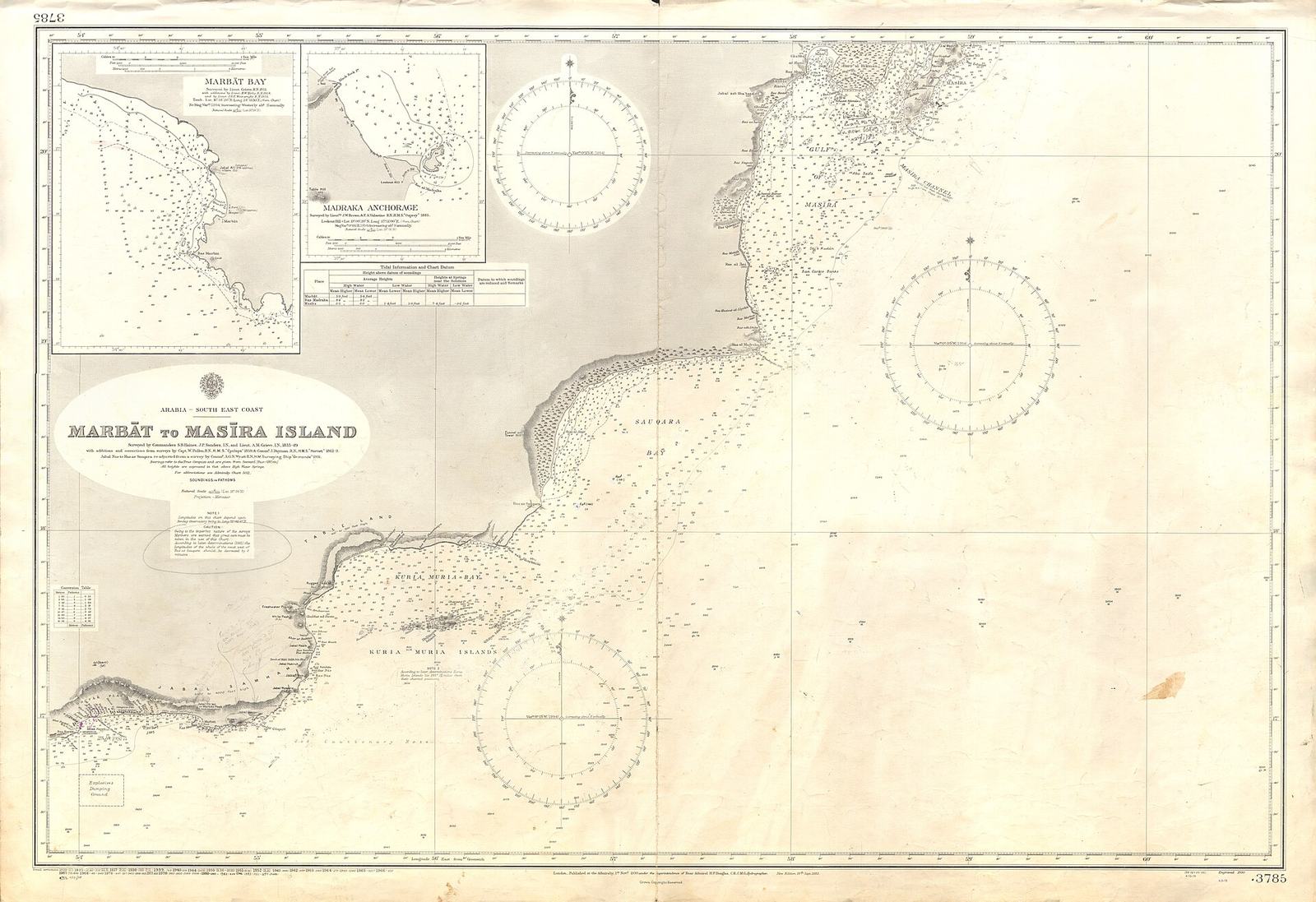
Photo: Admiralty Chart No 3785 Marbat to Masira Island, Published 1930.jpg · United Kingdom Hydrographic Office · Public domain (licence)
Before you go
8 facts, each with its source- Time needed Half a day — the boat timetable decides Source: editor · category default
- Best season October–May Source: editor · category default
- Difficulty Easy — the crossing can be rough Source: editor · category default
- Family friendly Yes Source: editor · category default
- Facilities Nothing mapped nearby — bring water, expect no toilets Source: osm · no facility mapped within 800 m
- Drones Permission required from CAA Oman — approvals have been suspended at times in 2026, so confirm the current position before you travel Source: official · national rule · Civil Aviation Authority (CAA Oman) · checked 2026-09-05
- Dress Oman expects shoulders and knees covered in public. Sun cover, and something for spray on the crossing. Source: editor · category default
- Elevation 16 m Source: srtm · NASA SRTM 30 m model
Not confirmed for this place: 4x4 needed · Entry fee · Opening hours · Wheelchair. Know one of these? Tell us →
Safety notes
- Boat trips depend on sea state; operators cancel in rough conditions. Bring reef-safe sunscreen and respect marine-reserve rules.
Editor notes, reviewed 2026-09-02
How far is it?
- 7 h 23 mfrom Muscat Airport (MCT) · 478 km
- 5 h 4 mfrom Duqm · 292 km
- 5 h 47 mfrom Ras Al Hadd · 311 km
Road distance and driving time from OpenStreetMap routing, without traffic. Mountain tracks are often slower than the router thinks.
When to go
October–May- J
- F
- M
- A
- M
- J
- J
- A
- S
- O
- N
- D
ComfortableToo hot
Boat trips depend on sea state; operators pause in rough summer seas.
Source: editor · category default · 2026-09-02. Category default set by the editor — a verified per-place season replaces it.
island in Oman
Short description from Wikidata (CC0) · Q1793853
About & Sources Al Masira
Al Masira is a island or stretch of coast in Ash Sharqiyah, Oman — Wikidata describes it as "island in Oman". Entry fee, opening hours and vehicle requirements have not yet been verified for this page — the fact box says so plainly rather than guessing, so check locally before you go. For this kind of place the comfortable season is typically October–May. Nearby: Jabal Shawkas, Jabal Tahawtah and Jibal al Amaim.
At a glance
- Islands & Coast · Ash Sharqiyah
- island in Oman
- Season: October–May (editor default)
- Has a Wikipedia article
- 2 open-data sources · verified not yet
Photos
Photos from Wikimedia Commons, each with its author and licence.
Frequently asked questions
When is the best time to visit Al Masira?
Typically October–May for islands & coast. Boat trips depend on sea state; operators pause in rough summer seas.
How long do I need at Al Masira?
Half a day — the boat timetable decides (guidance for this category).
What facilities are there at Al Masira?
Nothing mapped nearby — bring water, expect no toilets (source: osm).
How high is Al Masira?
About 16 m above sea level (source: srtm).
Where is Al Masira?
In Ash Sharqiyah (OM-SJ), Oman, at 20.4293, 58.7932 — near Jabal Shawkas, Jabal Tahawtah and Jibal al Amaim.
Who can take you there
All operators →Licensed local operators who run trips of this kind in this region. Contact them directly — we take no commission on an enquiry.
Are you a licensed operator who runs trips here? The first slot on this page is available to Verified operators for a flat monthly fee. No commission, and the enquiry goes straight to your WhatsApp.
Claim your listing →Operators are listed from open data and Ministry of Heritage and Tourism's public directory. Ranking places paying operators first; everything else is by relevance and distance, and the badges say exactly what has been verified.
Nearby places
More in Ash Sharqiyah →

Datta
mountain in Oman

Jabal Abu al Khashul
mountain in Oman

Juzayrah
island in Oman
Information is compiled from open data and editor checks; conditions, fees and access change — verify locally before you travel.